
reference Instrumentation & Strict Diagnostic Independence
Sightline Sewer was established to resolve a persistent conflict of interest in sub-surface drainage: plumbers and excavation contractors selling costly pipe replacement while diagnosing their own work. We provide pure, unconflicted visual proof and electromagnetic mapping.
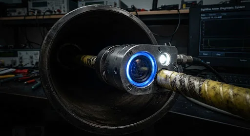
Independent third-party observer status illustrative. Zero commercial affiliation with plumbing franchises.
Instrumentation Rigs & Sub-Surface Sensors
Industrial-tier diagnostic equipment maintained to mil-spec tolerance. Purpose-selected for residential laterals, commercial collectors, and municipal tie-ins.
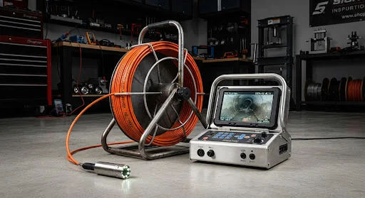
Modular Optical Push-Reel Rig
Primary lateral evaluation unit engineered for tight transitions, cleanout sweeps, and residential tie-ins. Delivers pristine optical clarification without line distortion.
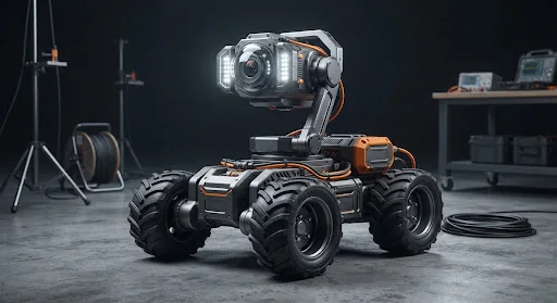
Steerable Robotic Mainline Crawler
Heavy remote platform for commercial mains, institutional storm networks, and structural trunk assessments requiring millimeter incline profiling.
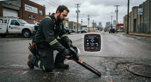
512Hz Precision Sonde Locator
Ground-penetrating electromagnetic signal receiver used to pinpoint the exact underground coordinates and depth of defects before any sawcutting or excavation.
Rigorous Condition Terminology, No Vague Hype
Plumbing contractors often use sensational words like "totally collapsed" or "imminent catastrophe" to induce rapid repair authorizations. We document anomalies according to defined structural failure classifications with exact physical metrics.
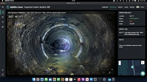
Misalignment of pipe joints measured in millimetres. Categorized as minor (<10mm), moderate (10–25mm), or severe (>25mm) based on sediment retention potential.
Groundwater penetrating joints or cracks under water-table head pressure. Often indicates broken external gaskets or weeping tile back-pressure.
Depressions where water pools due to inadequate pitch or subsoil subsidence. Graded by camera submersion percentage: 25%, 50%, or 100% full optical obstruction.
Differentiating between structural crush loads (running along pipe axis) versus point-shearing caused by differential ground shifting across frost lines.
| Chainage | Material | Condition Logged | Structural Severity | Action Recommendation |
|---|---|---|---|---|
| 14.2 ft | Cast Iron | Moderate internal tuberculation; pipe wall intact | Minor | No immediate intervention required |
| 28.0 ft | Transition | Cast-to-Clay transition ring; hairline root hair infiltration (<5% cross-section) | Moderate | Schedule maintenance clean within 12 mos |
| 42.8 ft | Clay Tile | Radial joint shear offset 18mm with visible backfill gravel intrusion | High | Spot excavation indicated; see Sonde GPS coordinates |
| 61.5 ft | Clay Tile | City main lateral junction; unrestricted discharge verified | Pass | Connection clear |
Strict Boundaries & The Diagnostic Code of Independence
An inspection report cannot be impartial if the inspector generates revenue by quoting thousands of dollars to dig up the lawn. We enforce a zero-conflict operating covenant.
Zero Repair Upselling
We never perform drain cleaning, snaking, hydro-jetting, trenching, cured-in-place pipe (CIPP) lining, or plumbing repairs. We make exactly zero dollars whether your sewer needs a $15,000 replacement or is completely clear.
Unbiased Evidence
Our recordings and analytical reports are raw, timestamped, continuous, and tamper-evident. You receive the complete continuous video file from entry to municipal city connection, not selectively clipped stills designed to frighten you.
Field Transparency
We transparently state our technical limits. If murky grease water, excessive mud, or an unpassable collapse prevents forward camera advance, we clearly log an "Optical Limit Reached" status rather than inventing a speculative conclusion.
Engineered Specifically for Red River Basin Heavy Clay
Winnipeg sits atop one of the most mechanically aggressive soil profiles in North America. Glaciolacustrine plastic clay swells substantially when saturated and contracts drastically during dry cycles, while extreme winter temperatures drive frost depth beyond 7 feet.
This soil behavior induces immense lateral shear forces on buried vitrified clay tile, transite, and cast-iron lines. Instead of typical uniform settling, prairie laterals experience knife-edge fractures, sheared joints, and abrupt negative slopes (bellies).
Need an impartial second opinion on your sewer line?
Before signing an authorization for a $10,000+ trenching or relining project, verify whether you actually need it. We deliver unalterable video footage, measured sonde depths, and an objective engineer-ready findings report.